Accessibility settings

Settings are saved in this browser and apply on every page of the site.

Text size 100%

Accessibility is built into the site code. This menu is an extra, not a substitute.

ST-00 Additional services A city in northern Israel

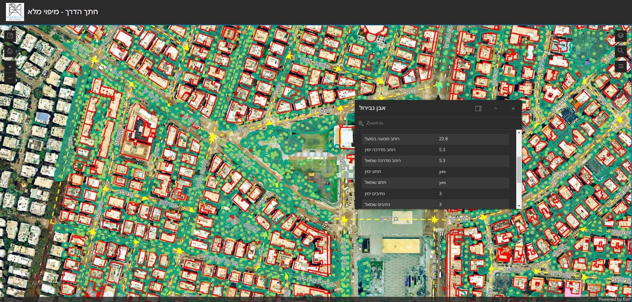
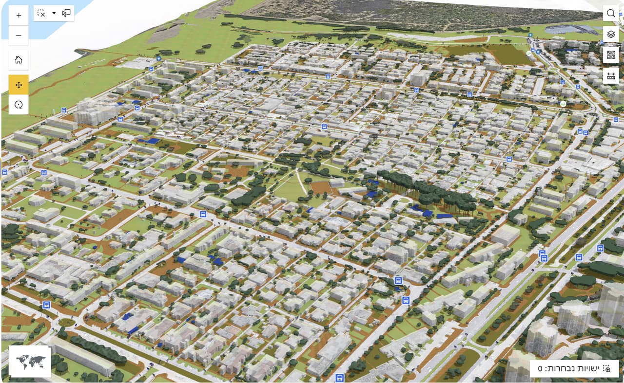
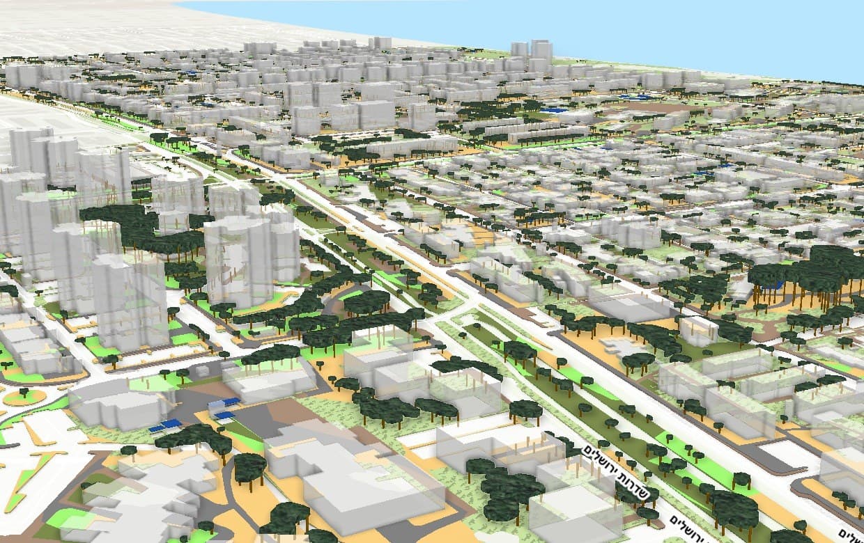
A public GIS and a 3D city scene

A public GIS for browsing the city's layers, and a 3D scene of the city from the coastline to its towers.

Source
ArcGIS · 3D city model
CRS
EPSG:2039 · E 197,860 · N 687,397

Loop from inside the software: Ortho-graphy 3D: a street in 3D built from aerial-photo layers

ST-01 The traverse

Challenge, solution, outcome

  1. ST-01

    The challenge

    City information shown only on a flat map is hard for the public to read, and high-rise development is easier to explain when you can see the city in volume. For residents and stakeholders to understand what is happening, the city needs a public system that also shows it in 3D.

  2. ST-02

    The solution

    We set up a public GIS for the city on ArcGIS with a layer list, and built a 3D scene of the city that users can fly through to look at buildings, streets and the coastline.

  3. ST-03

    The outcome

    Residents, developers and city staff browse the city's layers in a web browser, and can switch to 3D to look at buildings and streets in volume.
ST-02 What was delivered

Project deliverables

  1. Public web GIS
  2. 3D city scene
Client
A city in northern Israel
Source
ArcGIS · 3D city model

ST-05 Your next project

What do you want to move forward in your organisation?

Tell us what needs solving and we will come back with a proposed approach: a survey, a system, software, or a combination.