
ST-00

CLIMYX: Plan shade with data
Concept stage
CLIMYX is a product at concept stage: a tool for analysing urban heat islands and outdoor comfort at street level, made for urban planning. It builds on the heat-mapping projects HAMMER already delivers for municipalities, such as the Kiryat Yam pilot, where heat is mapped down to the path, the bus stop and the bench.
ST-01
ClimyxShowcase
ST-02 The problem
Heat isn't a citywide average
A satellite map shows that the city is hot. It doesn't show which bus stop stands in full sun at noon, which path never gets a moment of shade, or where a single tree or canopy would make the biggest difference. Without those answers, a shade plan stays a wish list and the budget spreads thin instead of going where it is needed.
ST-03 Working today
Urban heat mapping as a municipal service
Before there is software, there is a method. HAMMER maps urban heat islands as a project service, and that method is the foundation of CLIMYX.
-
Layers from aerial imagery
Tree canopies and their heights, shade structures and their heights, vegetation, asphalt, pavements and paths, artificial surfaces, buildings and their heights, and open areas.
-
Shade through the day
Shade is computed every half hour across the day, to show where shade falls and when it disappears.
-
An integrated heat model
Solar radiation, sun-exposure duration, changing shade and the thermal response of materials such as asphalt, concrete, metal and wood, combined with a 3D surface model (DSM) and remote sensing.
-
No street sensors
The mapping is computed from spatial data, with no sensors to deploy and maintain on the street.
-
A shade priority map
A map that shows where shading and planting will help most. Deliverables come as GIS layers and DWG.
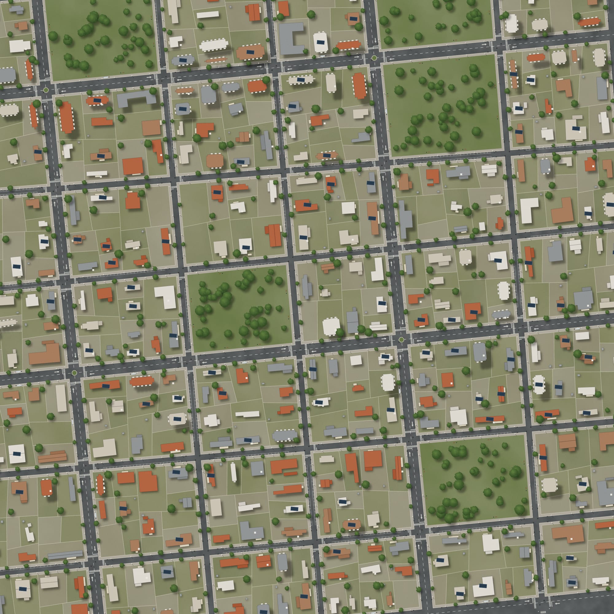
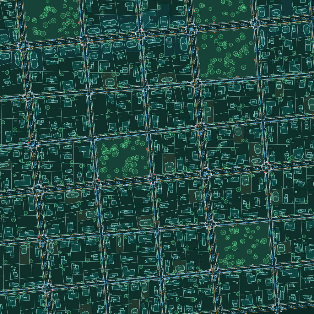
Legend
- Building (roof outline)
- Parcel
- Kerb and sidewalk
- Road centreline
- Lane marking
- Crosswalk and stop line
- Lane arrow
- Parking bay
- Traffic island
- Tree: canopy and trunk
- Street light
- Bench
- Bin
- Bus stop
- Water manhole
- Sewer manhole
- Drainage grate
- Water main
- Sewer
- Power line
- Stop
- Give way
- Pedestrian crossing (sign)
- Parking
ST-04 The method
From aerial photo to a priority map
-
ST-01
Imagery and elevation
An aerial photo and a 3D surface model.
-
ST-02
Layer extraction
Trees, shade structures, surface materials and buildings, each with its height.
-
ST-03
Shade through the day
Shade computed every half hour.
-
ST-04
Heat model
Radiation, exposure, shade and material thermal response combined.
-
ST-05
Priorities
A map that shows where to start shading and planting.
ST-05 From the field
The Kiryat Yam pilot
In Kiryat Yam we mapped the heat hotspots across the city's streets and built a map showing where shade and tree planting would have the most effect. That is the work CLIMYX is meant to turn into a standing tool.
-
Urban heat island mapping (video) (opens in a new window)
HAMMER's method for street-level heat mapping.
ST-06 Where CLIMYX is heading
A direction, not an off-the-shelf product
These are the directions we are exploring. The final scope is still being set, and nothing on this list is available as software today.
-
The city in 3D
Buildings and terrain in 3D on a web map.
-
Radiation and heat islands
Solar-radiation and heat-island indicators at street level.
-
Thermal comfort
Indicators such as sky view factor (SVF), mean radiant temperature (MRT) and UTCI.
-
Scenario comparison
Testing design alternatives against each other before money goes into construction.
ST-07 Who it's for
For whoever decides where the shade goes
Urban planners
Spatial evidence of where the street is hot and where an intervention will matter most.
Climate and sustainability teams
A data foundation for a shade plan and for climate adaptation.
Authorities that want to start now
The heat-mapping service is available today, no need to wait for the software.
ST-08 Deliverables
What a heat-mapping project delivers
- GIS layers Trees, shade structures, surface materials and buildings with heights
- DWG The same layers for design work
- Priority map Where to shade and plant first
ST-09 Status
Concept stage
CLIMYX is not available yet: there is no customer release and no customers for the product. What is available today is HAMMER's urban heat-mapping service. Municipalities that want a say in where CLIMYX goes are welcome to talk to us.
ST-10 A real example
Want to see what this looks like for another municipality?
We will send you a sample heat-island map and a short thermal analysis report from a project we delivered, so you can judge the resolution and the deliverables before talking budget.
ST-11 FAQ
Questions and answers
What is CLIMYX?
CLIMYX is an upcoming HAMMER product for analysing urban heat islands and outdoor comfort at street level, as a tool for urban planning. It is at concept stage and builds on the heat-mapping projects HAMMER delivers to municipalities as a service.
Can we buy CLIMYX today?
No. CLIMYX is not available yet. You can commission an urban heat-mapping project today, based on the same method.
What is an urban heat island, and why should a municipality care?
Part of a city that runs hotter than its surroundings because of asphalt, concrete and a lack of shade and vegetation. Extreme heat hits older people and children hardest and drives people out of public space. Precise mapping lets a municipality put shade and planting where they are needed.
How do you map heat without sensors?
In HAMMER's method the map is computed: layers from aerial imagery, a 3D surface model, shade calculated through the day, and the thermal response of materials such as asphalt, concrete, metal and wood. The result is a street-level map with no sensors to deploy.
What happened in the Kiryat Yam pilot?
We mapped the heat hotspots in the city's streets and built a map showing where shade and tree planting would have the most effect.
How is this different from a satellite heat map?
Satellite heat maps show the city at coarse resolution. HAMMER's method relies on aerial imagery and an elevation model, so it can tell the shaded side of a street from the exposed one, and one bus stop from the next.
Can the output serve as a certified microclimate study?
No. The mapping is a prioritisation and planning tool, not a substitute for a certified microclimate study or an engineering assessment.
Do we need street sensors to map heat islands?
No. HAMMER's mapping is computed from the aerial photo, a surface model (DSM), shade cast through the day and the thermal response of materials such as asphalt, concrete and metal. Sensors can validate the result; they are not a precondition.
How fine is the resolution?
Street level: a path, a bus stop, a bench. That is the difference from satellite maps, which show a hot neighbourhood but not which stop stands in full sun at noon.
What does the municipality receive?
GIS and DWG layers of the heat factors (tree canopies, shelters, surfaces, buildings with heights), the shade sequence through the day and a priority map showing where shading and planting matter most. The expected effect of each intervention is quantified per project, from what is measured or modelled for your city, not from a generic figure.
ST-12
Want to know where your city runs hottest?
We'll present the heat-mapping method and the Kiryat Yam pilot, and look at what we can map for you right now.
Legend
- Building (roof outline)
- Parcel
- Kerb and sidewalk
- Road centreline
- Lane marking
- Crosswalk and stop line
- Lane arrow
- Parking bay
- Traffic island
- Tree: canopy and trunk
- Street light
- Bench
- Bin
- Bus stop
- Water manhole
- Sewer manhole
- Drainage grate
- Water main
- Sewer
- Power line
- Stop
- Give way
- Pedestrian crossing (sign)
- Parking