Accessibility settings

Settings are saved in this browser and apply on every page of the site.

Text size 100%

Accessibility is built into the site code. This menu is an extra, not a substitute.

ST-00 Surveys A local council

Gardening and water-meter survey with a navigation dashboard

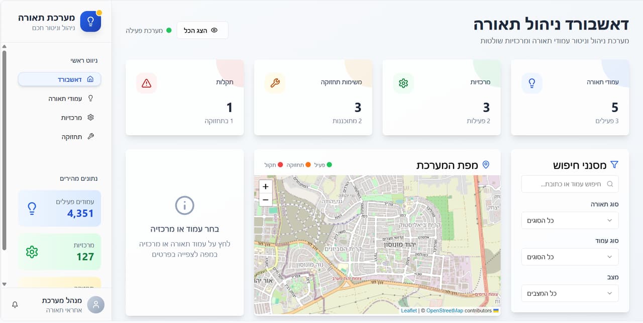
Trees and irrigation water meters in GIS layers, with a dashboard of counters, charts and a map that navigates to any item from a desktop or a phone.

Source
Field survey
CRS
EPSG:2039 · E 178,648 · N 603,621

Loop from inside the software: Gardening and water-meter survey dashboard: counters, chart and tree map updating

ST-01 The traverse

Challenge, solution, outcome

  1. ST-01

    The challenge

    Planning irrigation, pruning and contractor oversight means knowing where every tree and every water meter is. When that information is scattered across spreadsheets and contractors, the green estate is hard to manage.

  2. ST-02

    The solution

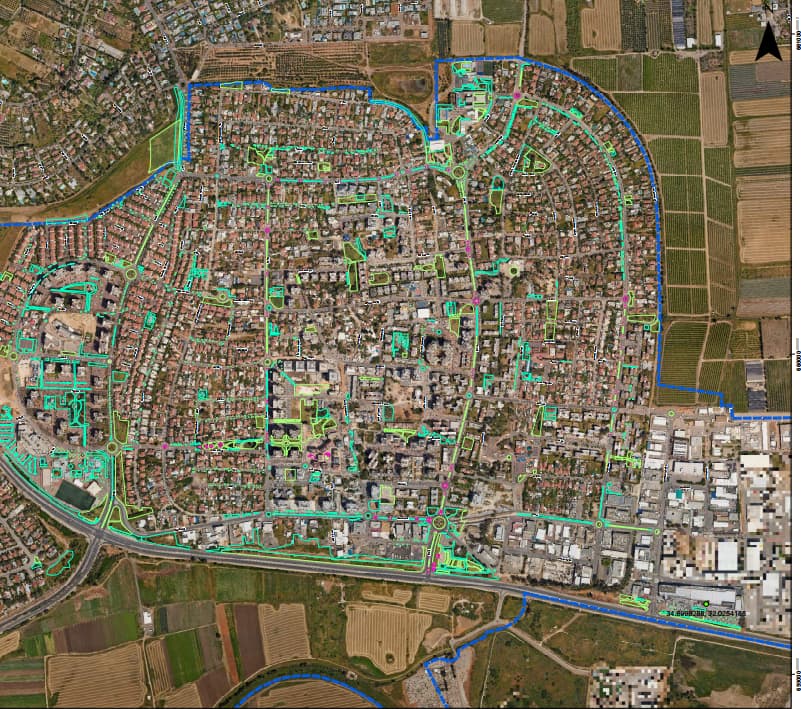
    We surveyed the council's green areas and mapped trees and water meters into GIS layers. On top of the layers we built a dashboard with counters, charts and a map, with navigation to any selected item from an office desktop or a phone in the field.

  3. ST-03

    The outcome

    Parks managers see the tree and water-meter inventory at a glance, and a field worker navigates straight to the tree or meter that needs checking.
ST-02 What was delivered

Project deliverables

  1. GIS layers of trees and water meters
  2. Dashboard with counters, charts and a map
  3. Navigation to items on desktop and phone
Client
A local council
Source
Field survey

ST-05 Your next project

What do you want to move forward in your organisation?

Tell us what needs solving and we will come back with a proposed approach: a survey, a system, software, or a combination.